1. GPS and Earth
1.1 gpx-files für GPS-instruments
(download mit right Maus click - Ziel speichern unter)
Lap 1 / Runde 1
Lap 2 / Runde 2
Lap 3 / Runde 3
Lap 4 / Runde 4
1.2 kml-files für Google Earth (or use .gpx directly) (download mit right Maus click - Ziel speichern unter)
Lap 1 / Runde 1
Lap 2 / Runde 2
Lap 3 / Runde 3
Lap 4 / Runde 4
1.2 Der gesamte Kurs interaktiv in Google Earth (prepared by Chris Wolfe)
Gib diese URL in Deinen Browser
ein (kopieren-einfügen), enter the following URL (copy/paste) into your browser:
http://maps.google.com/maps/ms?hl=en&ie=UTF8&msa=0&msid=107949080196571604869.000487551bcefd900650a&t=h&z=11
2.
Karten - Maps
2.1. NEUE
KARTEN 2010 (.pdf-files)
Print the maps and bring to the race please!
Bitte Drucke die Karten aus und bringe sie zum Lauf!
Lap 1 / Runde 1
G100_RUNDE_1A
G100_RUNDE_1B
G100_RUNDE_1C
G100_RUNDE_1D
G100_RUNDE_1E
G100_RUNDE_1F
G100_RUNDE_1G
Lap 2 / Runde 2
G100_RUNDE_2A
G100_RUNDE_2B
Lap 3 / Runde 3
G100_RUNDE_3A
G100_RUNDE_3B
Lap 4 / Runde 4
G100_RUNDE_4
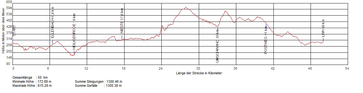
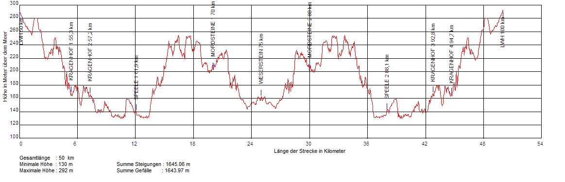
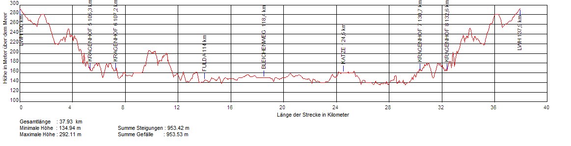
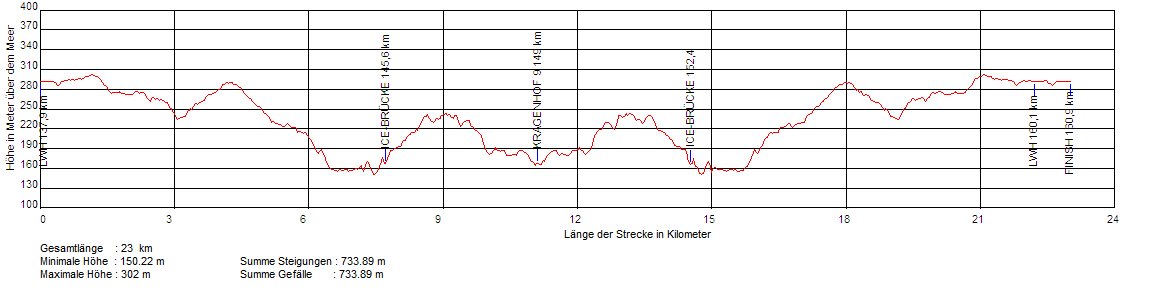
2.2. ELEVATION PROFILE / HÖHENPROFILE
Runde
1 / Lap 1
Runde 2 / Lap 2
Runde 3 / Lap 3
Runde 4 / Lap 4